home *** CD-ROM | disk | FTP | other *** search
/ UK & Ireland MW & LW Transmitters / UK & Ireland - MW & LW Transmitters.iso / UK & Ireland LW & MW Transmitters / BBC maps / BBC Humber.jpg < prev    next >
Joint Photographic Experts Group Image  |  2005-05-11  |  28KB  |  488x656  |  16-bit (25,532 colors)
Labels: earth | fence | map | poster | railing | road | sky | tree | windowpane
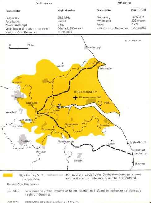
OCR: VHF service MF service Transmitter High Hunsley Transmitter Paull (Hull) Frequency 95.9MHz Freguency 1485 KH2 Polarisation mixed Wavelength 202 metres Power (max erp 9 kW Power 2kW Mean height transmitting veriat 66m 230m 30d National Grid Referencs TA 168258 National Grid Reterence SE 945350 FID LR67DF km carborough Iridtington HIGH HUNSLEY uoon elord PAULI Wakefreld Mablethorpe Chape St Wor Leanards Higt Hunstey VHI ME Daytirme Service Area (Night tine coverage mon Service Area restricted dn Tr inter ference from othe transmitters) Sarvice Area Boundaries For VHF correspond 10a freld strength ot 54 dB (rolative to1 V/m in the horizontal plant at. height of 10 metres For corresponn 13 fiele strenott mV/m Freciency erpl Powe gerial uDon efull Wakafield Daytime mote other transnitters horiz ...